
2N04
2N04 is a green trail that runs from highway 38 to 2N01. It
is a very scenic trail that offers no real difficultiy for any vehicle.
The Pacific Crest National Scenic Trail passes through 2N04 as does
Arrasta Creek. This trail is maintaned by the North
American XJ Association.
Click on the below map for a printable PDF.
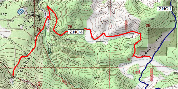
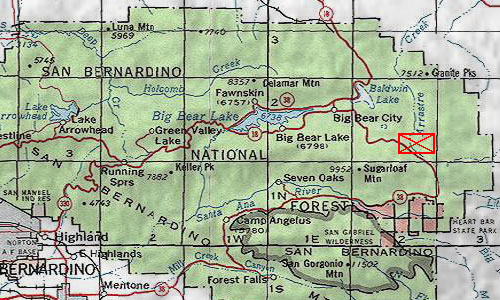
Overview Locator
GPS Waypoints
Starting from Highway 38 and going toward 2N01
34° 13.189 N • 116° 45.461
W
34° 13.414 N • 116° 45.356 W
34° 13.423 N • 116° 45.260 W
34° 13.535 N • 116° 45.158 W
34° 13.655 N • 116° 45.137 W
34° 13.746 N • 116° 45.045 W
34° 13.875 N • 116° 44.988 W
34° 13.849 N • 116° 44.956 W
34° 13.995 N • 116° 44.992 W
34° 13.857 N • 116° 44.864 W
34° 13.726 N • 116° 44.911 W
34° 13.661 N • 116° 44.819 W
34° 13.702 N • 116° 44.741 W
34° 13.690 N • 116° 44.571 W
34° 13.743 N • 116° 44.476 W
34° 13.726 N • 116° 44.402 W
34° 13.614 N • 116° 44.348 W
34° 13.681 N • 116° 44.207 W
34° 13.643 N • 116° 44.172 W
34° 13.711 N • 116° 43.822 W
34° 13.675 N • 116° 43.695 W
34° 13.614 N • 116° 43.695 W
34° 13.552 N • 116° 43.783 W
34° 13.420 N • 116° 43.805 W
34° 13.406 N • 116° 43.702 W
34° 13.388 N • 116° 43.543 W
Comma Seperated Value document of above.
Note: Order is Name, Longitude, Longitude Minutes,
Latitude, Latitude Minutes, Elevation, Date, Time. Format is NAD83
©1998
- 2007 Sequoia4x4.com
All images property of Sequoia4x4.com & SequoiaSite.com.